| Top rated - Marple |

BrentwoodBrentwood Recuperation Centre on Church Lane. Now McNair Court.    
(7 votes)
|
|

Rose Hill StationRose Hill Railway Station looking towards Middlewood.    
(4 votes)
|
|

Throstle Bank FarmThrostle Bank Farm, also known as Throstle Grove Farm, at Rose Hill. From Marple Local History Society Archives.    
(3 votes)
|
|

Seventeen WindowsA shot of Seventeen Windows showing how it got its name, probably taken in the late 1950s or early 1960s.    
(3 votes)
|
|

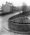
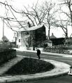
Church LaneA top quality image looking up Church Lane with the Alm Houses and the Carriage House on the left and the Round House on the right.    
(3 votes)
|
|

Shopping Area Improvements August 1962-17: Shops on Market StreetWhat is now Boots the Chemist on Market Street. One of a series of photos taken in August 1962 entitled Marple Shopping Area Improvements.    
(3 votes)
|
|

01 - Marple District Centre 1970Hibbert Lane / Church Lane junction during extension to Stockport Road in 1970. Position 1 on UDC plan. From MLHS Archives.    
(2 votes)
|
|

Church Street & Empress AvenueThe corner of Church Street and Empress Avenue c1902. All Saints' old and new schools are visible in the background (the old school was demolished in 1902). The wall in the foreground is still clear to see surrounding Marple Cottage Surgery. From a glass slide in Marple Local History Society's archives.    
(2 votes)
|
|

Brabyns LodgeBrabyns Lodge viewed from the corner of Arkwright Road.    
(2 votes)
|
|

Brabyns Lodge 1978Brabyns Lodge, from the Marple Civic Society Archives, dated 1978.    
(2 votes)
|
|

Marple MultiviewA sepia multiview card featuring All Saints' Church, Marple Hall and Marple Hall Gates, Seventeen Windows and Dan Bank.    
(2 votes)
|
|

Hollins Mill 1957Demolition of Hollins Mill in 1957. Photos taken by artist Paul Keen.    
(2 votes)
|
|
| 526 files on 44 page(s) |
 |
23 |  |
|

