| Most viewed - Marple |

Woodville Hall 1994643 viewsDemolition of Woodville Hall in 1994, from Marple Local History Society Archives.
|
|

Memorial Park 1960s643 viewsMarple Memorial Park (first Teen Shelter) taken by Gordon Mills c1960.
|
|

Alan Drive643 viewsAlan Drive just after being built, taken by Gordon Mills. From Marple Local History Society Archives.
|
|

Brabyns Brow642 viewsThe bottom of Brabyns Brow looking down into Marple Bridge. From Marple Local History Society Archives.
|
|

Stone Row642 viewsStone Row, homes built by Samuel Oldknow for his workers. From Marple Local History Society Archives.
|
|

Dan Bank Toll House641 viewsA close up view of the Toll House on Dan Bank from the direction of Marple.
|
|

Mineral Mill and Bleak House641 viewsThis image of the Mineral Mill (long demolished) as it would have been alongside Bleak House was created from two separate photos on the Virtual Tour by Noel Brindley.
|
|

29 - Marple District Centre 1970640 viewsChurch Lane from the Pineapple Public House to the Carver Theatre in 1970. Position 29 on UDC plan. From MLHS Archives.
|
|

St James's Terrace640 viewsSt James Terrace, off Hollins Lane. Provided by Janet Holmes.
|
|

Marple Multiview639 viewsA hand coloured multiview card featuring Dan Bank, Stockport Road and the Jolly Sailor Road Junction. Postmarked 1970.
|
|

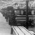
Inside Hollins Mill639 viewsA close-up inside Hollins Mill from a glass slide provided by Alan McDowell.
|
|

Shopping Area Improvements August 1962-01: Church Lane638 viewsChurch Lane at the top of Market Street. From Marple Local History Society Archives. One of a series of photos taken in August 1962 entitled Marple Shopping Area Improvements.
|
|
| 2085 files on 174 page(s) |
 |
69 |  |
|

