| Most viewed - Marple |

07 - Marple District Centre 1970721 viewsWalsh's Timber Yard on Derby Street in 1970. This is now the location of the entrance to Derby Street Car Park. Position 7 on UDC plan. From MLHS Archives.
|
|

280 Stockport Road 721 viewsThe view from 280 Stockport Road in 1932. From Marple Local History Society Archives.
|
|

Stockport Road (Hibbert Lane junction)720 viewsBraddock's Garage alongside the houses demolished to make way for the extension to Hibbert Lane in 1960s. From Marple Local History Society Archives.
|
|

Church Lane (Hibbert Lane Junction) 720 viewsThe junction of Church Lane and Hibbert Lane before the link to Stockport Road was added in 1960s. From Marple Local History Society Archives.
|
|

Lime Kiln Farm717 viewsFrom the Hinchliffe collection - One man and his cow at Lime Kiln Farm.
|
|

Wood Farm 1981717 viewsWood Farm, from the Marple Civic Society Archives, dated 1981.
|
|

Ivy House, Cross Lane 1902717 viewsInteresting for what's not there - this is Ivy House viewed from Cross Lane with the Rose Hill Brickworks chimney in the distance. Taken by Arthur Hulme in 1902. From Marple Local History Society Archives.
|
|

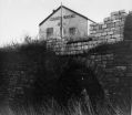
British Legion716 viewsThe old British Legion, sat on top of the Lime Kilns.
|
|

Mineral Mill716 viewsA view of the Mineral Mill from Strines Road, Bleak House is just to the right.
|
|

Jolly Sailor Interior716 viewsInside the Jolly Sailor public house.
|
|

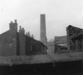
Hollins Mill Chimney716 viewsThe Hollins Mill Chimney during course of demolition viewed with Emily Street on left and Church Street on right. Provided by Ray Noble.
|
|

Brabyns Brow715 viewsView down Station Road towards Brabyns Brow. From Marple Local History Society Archives.
|
|
| 2085 files on 174 page(s) |
 |
54 |  |
|

