| Most viewed - Marple |

Chadwick Street Parish Hall817 viewsThe Parish Hall on Chadwick Street.
|
|

Hollins Mill 1957816 viewsDemolition of Hollins Mill in 1957. Thomas & John Carver and Samuel & Edwin Hodgkinson brought the mill in 1859.
|
|

Hollins Mill 1957816 viewsDemolition of Hollins Mill in 1957. Sheeting produced at the mill was sold as "Marple Sheets".
|
|

Station Road816 viewsLooking up Station Road from the junction with Stockport Road outside the Jolly Sailor. From Marple Local History Society Archives.
|
|

Shops on Stockport Road816 viewsShops near the Post Office on Stockport Road, from Marple Local History Society Archives.
|
|

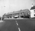
Jolly Sailor Shops 1960s816 viewsThe shopping parade on Stockport Road c1960, taken by Gordon Mills.
|
|

Simmondley 1978815 viewsSimmondley is on the road from Charlesworth to Glossop, so we're not sure why this is in the Civic Society Archives. It's dated 1978.
|
|

Brabyns Brow815 viewsLooking up Brabyns Brow with a good view of Brabyns Lodge.
|
|

Greenbank House814 viewsGreenbank House on Hibbert Lane, Greenbank Crescent was obviously names after this house.
|
|

Brabyns Brow Crash 1930811 viewsA different angle on the crash on Marple Bridge while it was being widened in 1930. From Marple Local History Society Archives.
|
|

Marple Multiview810 viewsA black and white multiview card featuring Memorial Park, Brabyns Park, the Canal, Top Lock and a view from the Ridge.
|
|

Stockport Road (Possett Bridge)810 viewsLooking down Stockport Road from Possett Bridge with Lock 13 and the Liberal Club in view.
|
|
| 2085 files on 174 page(s) |
 |
42 |  |
|

