| Most viewed - Marple |

12 - Marple District Centre 1970850 views62 Market Street at the end of the block on Church Lane in 1970. Currently a dentist. Position 12 on UDC plan. From MLHS Archives.
|
|

Marple Dale Farm Colony849 viewsThe mens quarters at the Marple Dale Farm Colony.
|
|

Station Road848 viewsA hand coloured version of the earlier picture compared to the present day shot of Station Road.
|
|

Wood Farm848 viewsWood Farm, beyond Marple Rugby Club's grounds off the Middlewood Way. From Marple Local History Society Archives.
|
|

Brabyns Lodge846 viewsA very similar photo of Brabyns Lodge to the last except for the person at the door.
|
|

Brabyns Brow near Lock 9846 viewsA hand coloured copy of the same photo looking down Brabyns Brow where it crosses the canal at Lock 9.
|
|

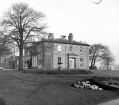
Hollins House 1960846 viewsMarple Council Offices, Hollins House, taken by Gordon Mills on Christmas Day 1960.
|
|

Brabyns Brow near Lock 9845 viewsLooking down Brabyns Brow at the spot where it crosses the canal at Lock 9.
|
|

Church Lane (Hibbert Lane junction)844 viewsCottages on the car park opposite Littlewoods Butchers in 1984. From Marple Local History Society Archives.
|
|

Ridge Quarry844 viewsA gent enjoys the view from Marple Ridge Quarry. From Marple Local History Society Archives.
|
|

Ridge Cottages843 viewsCottages on the Ridge with the Ridge Methodist Church just visible in the background.
|
|

Brabyns Lodge841 viewsA different view of Brabyns Lodge, looking uphill toward the canal.
|
|
| 2085 files on 174 page(s) |
 |
38 |  |
|

