| Most viewed - Marple |

Hollins Mill867 viewsHollins Mill during demolition in 1957.
|
|

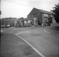
Stockport Road Gable end repairs 867 viewsRepairs to the gable end of a house at the junction of Church Lane and Stockport Road in December 1993. From Marple Local History Society Archives.
|
|

Church Lane (Hibbert Lane Junction)866 viewsThe junction of Church Lane and Hibbert Lane before the link to Stockport Road was added in 1960s. Cheshire Interiors was where Littlewoods Butchers is now. From Marple Local History Society Archives.
|
|

Marple Multiview865 viewsA sepia multiview card featuring Marple Bridge, Roman Lakes, Memorial Park, Compstall Brow and Brentwood Recuperation Centre.
|
|

Church Lane (Hibbert Lane junction)865 viewsCottages on the car park opposite Littlewoods Butchers in 1984. From Marple Local History Society Archives.
|
|

Brabyns Brow Crash863 viewsAnother crash on Brabyns Brow. Updated with new copy from Marple Local History Society Archives 12 February 2011.
|
|

Chadwick Street862 viewsRear view towards Market Street from 32 Chadwick Street. Trinity Chapel in centre.
|
|

Marple High School862 viewsThe High School on Arkwright Road, Marple, now Brabyns Preparatory School. Provided by Janet Holmes.
|
|

Christmas in Hollins Mill Canteen861 viewsWorkers at the Hollins Mill gather for a Christmas photo in the works canteen, early 1950s.
|
|

Marple from the Air860 viewsEarly 1960s view of Marple from the air showing Shirley Avenue and Brindley Avenue roughly in centre. Click photo for a larger version.
Updated with new image from Marple Local History Society Archives 27 March 2010.
|
|

The Romper 1978860 viewsThe Romper, from the Marple Civic Society Archives, dated 1978.
|
|

Marple Multiview858 viewsA black and white multiview card featuring The Hollins, Market Street, the Aqueduct and Viaduct and the locks.
|
|
| 2085 files on 174 page(s) |
 |
36 |  |
|

