| Most viewed - Marple |

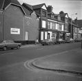
Stockport Road 1930s942 viewsA view of Stockport Road Rose Hill area taken from the 1930s development. From Marple Local History Society Archives.
|
|

Junction with Lockside941 viewsThe junction of Stockport Road and Lockside.
|
|

Goyt Council Houses941 viewsTaken from the top of All Saints' Church Tower in the 1960s during the early stages of construction of the Goyt Estate.
|
|

Greenbank House938 viewsGreenbank House on Hibbert Lane. It was next to the college grounds roughly where the sheltered housing is opposite Willow Court.
|
|

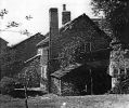
Peace Farm938 viewsPeace Farm on Stockport Road, also known as The Place. From Marple Local History Society Archives.
|
|

Regent Cinema 1978937 viewsRegent Cinema, Grease is showing. From the Marple Civic Society Archives, dated 1978.
|
|

Church Lane936 viewsA sepia version of a postcard showing the bottom end of Church Lane.
|
|

280 Stockport Road936 viewsA young lady thought to be Marjorie Hare at 280 Stockport Road in 1932. Note the cobbled road. From Marple Local History Society Archives.
|
|

Junction with Hollins Lane935 viewsThe junction of Stockport Road and Hollins Lane today.
|
|

Marple Railway Station934 viewsMarple Railway Station viewed from the Romiley end. On the left in the distance you can just make out the old goods storage shed that was where the car park is today.
|
|

Hibbert Lane933 viewsHibbert Lane in 1910.
|
|

Norbury Smithy932 viewsNorbury Smithy on Stockport Road. From Marple Local History Society Archives.
|
|
| 2085 files on 174 page(s) |
 |
29 |  |
|

