| Most viewed - Dan Bank and Dooley Lane Area |

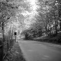
Charkirk Woods473 viewsChadkirk Woods, provided by Janet Holmes.
|
|

Dan Bank 1960s472 viewsDank Bank in the 1960s, taken by Gordon Mills.
|
|

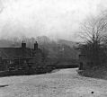
Otterspool Bridge469 viewsOtterspool Bridge, c1902. From a glass slide in Marple Local History Society's archives.
|
|

Chadkirk Chapel c1900-1910462 viewsA view of Chadkirk Chapel from a glass slide provided by Marple Local History Society.
|
|

Dan Bank Toll House460 viewsA poor quality hand coloured postcard featuring horses near the old Toll House on Dan Bank.
|
|

Farming at Chardkirk460 viewsHarvest time at Chadkirk during World War I. From Marple Local History Society Archives.
|
|

Stag and Pheasant Pub457 viewsThe Stag and Pheasant Pub, Chadkirk, with Otterspool Bridge in the background. From Marple Local History Society Archives.
|
|

Stag and Pheasant Pub457 viewsThe Stag and Pheasant Pub down at Otterspool Bridge. Provided by Janet Holmes.
|
|

Dan Bank Toll House c1900-1910456 viewsAnother classic shot of the Toll House on Dan Bank from a glass slide provided by Marple Local History Society.
|
|

Jessie Field456 viewsJessie Field near Nab Wood Farm in the Dooley Lane area. From Marple Local History Society Archives.
|
|

Dan Bank Farm455 viewsDank Bank Farm, from Marple Local History Society Archives.
|
|

Chadkirk House & Chapel451 viewsChadkirk House and Chapel. From a glass slide in Marple Local History Society's archives thought to be around 1902.
|
|
| 183 files on 16 page(s) |
 |
7 |  |
|


