| Most viewed - Dan Bank and Dooley Lane Area |

Dan Bank Road Widening369 viewsOvernight works on Dan Bank during the road widening on 12 February 2011. By Arthur Procter.
|
|

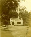
Dan Bank Toll House368 viewsA close up view of Dan Bank Toll House from Marple Local History Society Archives.
|
|

Chadkirk Chapel367 viewsChadkirk Chapel, provided by Janet Holmes.
|
|

Otterspool Bridge363 viewsVisitors pose on Otterspool Bridge. Provided by Janet Holmes.
|
|

Dan Bank Road Widening362 viewsOvernight works on Dan Bank during the road widening on 12 February 2011. By Arthur Procter.
|
|

Dan Bank Road Widening361 viewsOvernight works on Dan Bank during the road widening on 12 February 2011. By Arthur Procter.
|
|

Chadkirk Estate357 viewsChadkirk Estate during the reign of George VI, from Marple Local History Society Archives.
|
|

Dan Bank Road Widening356 viewsOvernight works on Dan Bank during the road widening on 12 February 2011. By Arthur Procter.
|
|

Dan Ban Toll House355 viewsDan Bank Toll House with a great view of the old stone fence posts, some of which can still be seen. Provided by Janet Holmes.
|
|

Chadkirk Estate351 viewsChadkirk Estate during the reign of George VI, from Marple Local History Society Archives.
|
|

Dan Bank Road Widening347 viewsDan Bank in the daytime during the road widening. Taken on 12 February 2011 by Arthur Procter.
|
|

Chadkirk Estate346 viewsChadkirk Estate during the reign of George VI, from Marple Local History Society Archives.
|
|
| 183 files on 16 page(s) |
 |
11 |  |
|


