| Last additions - Marple |

Shops on Stockport RoadWe're faithfully assured that this shop once stood on Stockport Road.Jul 11, 2006
|
|

Norbury SmithyThe rear of Norbury Smithy formerly on the opposite corner of Cross Lane to the Bowling Green (which is now gone too!)Jul 11, 2006
|
|

Chadkirk FarmChadkirk Farm, probably in the 1960s.Jul 11, 2006
|
|

Not sure?Not sure where this is. Can you tell us?Jul 11, 2006
|
|

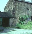
Navigation OutbuildingsThese old outbuildings belonging to the Navigation Hotel were photographed in the 1960s.Jul 11, 2006
|
|

Worrall's Hardware StoreJ. H. Worrall's Hardware Store, opposite the Navigation Hotel in the 1960s. Sold everything!Jul 11, 2006
|
|

Church Lane StoreChurch Lane Store (now The Fisherman's Table) probably around 1960s.Jul 11, 2006
|
|

Stag and Pheasant PubThe Stag and Pheasant Pub as it is today.Jul 11, 2006
|
|

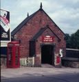
Marple Station North PlatformThe entrance to the north platform of Marple Station in 1969.Jul 11, 2006
|
|

Stag and Pheasant PubThe Stag and Pheasant Pub, Chadkirk, in 1895 with Otterspool Bridge in the background.Jul 11, 2006
|
|

Marple Station EntranceThe main entrance to Marple Station in 1970, demolition almost complete.Jul 11, 2006
|
|

Marple Station EntranceThe main entrance to Marple Station in 1969, just prior to demolition.Jul 11, 2006
|
|
| 2085 files on 174 page(s) |
 |
168 |  |
|

