Stockport Road (Northwest)
|
|
|

Corner of Church LaneThe corner of Church Lane and Stockport Road. From Marple Local History Society Archives.
|
|

Farming on Stockport RoadA view from Stockport Road, somewhere between Dan Bank and the Railway. From Marple Local History Society Archives.
|
|

Haymaking on Kayswood 1938/39Haymaking on Kayswood Road (now behind 269-277). The young girls are believed to be Barbara Preston (then Clark) and her sister. From Marple Local History Society Archives.
|
|

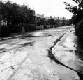
Isherwood Drive c1956Isherwood Drive from Marple Hall Drive, looking east. From Marple Local History Society Archives.
|
|

Isherwood Drive c1956Isherwood Drive from Marple Hall Drive, looking east. From Marple Local History Society Archives.
|
|

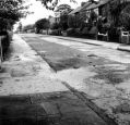
Isherwood Drive c1956Outside 20 Isherwood Drive looking west. From Marple Local History Society Archives.
|
|

Isherwood Drive c1956Outside 20 Isherwood Drive looking west. From Marple Local History Society Archives.
|
|

Jolly SailorThe Jolly Sailor Pub and cottages at the junction of Stockport Road and Station Road.
|
|

Jolly SailorA view of the Jolly Sailor and Cottages from the end of Church Lane.
|
|

Jolly SailorA view of the Jolly Sailor and Cottages from the end of Church Lane before recent demolition.
|
|

Jolly SailorA view along Stockport Road towards the Jolly Sailor in recent times, before demolition.
|
|

Jolly SailorA view along Stockport Road towards the Jolly Sailor.
|
|
| 131 files on 11 page(s) |
 |
3 |  |
|

