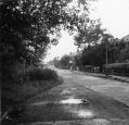
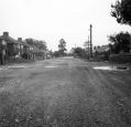
Stockport Road (Northwest)
|
|
|

Bowling GreenA good view of the Bowling Green on the corner of Cross Lane.
|
|

Bowling GreenDemolition of the Bowling Green pub, from Marple Local History Society Archives.
|
|

Bowling GreenDemolition of the Bowling Green pub, from Marple Local History Society Archives.
|
|

Church Lane / Stockport Rd JunctionDerelict shop and Smithy owned by Billy Walker on the junction of Church Lane and Stockport Road. Demolished in 1943 and now the site of Jolly Sailor steps. This view is from Stockport Road around where Marple News is today. From Marple Local History Society Archives.
|
|

Church Lane / Stockport Rd JunctionDerelict shop and Smithy owned by Billy Walker on the junction of Church Lane and Stockport Road. Demolished in 1943 and now the site of Jolly Sailor steps. This view is further up Church Lane. You can see the Peninsula building far right and market stalls over the road on the left. From Marple Local History Society Archives.
|
|

Church Lane / Stockport Rd JunctionDerelict shop and Smithy owned by Billy Walker on the junction of Church Lane and Stockport Road. Demolished in 1943 and now the site of Jolly Sailor steps. This view is from Church Lane roughly where the Texaco Garage is today. You can just see the Peninsula building far left. From Marple Local History Society Archives.
|
|

Church Lane / Stockport Rd JunctionDerelict shop and Smithy owned by Billy Walker on the junction of Church Lane and Stockport Road. Demolished in 1943 and now the site of Jolly Sailor steps. This view is from roughly where the Sushi Bar is today. From Marple Local History Society Archives.
|
|

Claremont Avenue c1956Claremont Avenue from Marple Hall Drive looking west. From Marple Local History Society Archives.
|
|

Claremont Avenue c1956Outside 20 Claremont Avenue looking west. From Marple Local History Society Archives.
|
|

Claremont Avenue c1956Outside 20 Claremont Avenue looking west. From Marple Local History Society Archives.
|
|

Claremont Avenue c1956Outside 45 Claremont Avenue looking west. From Marple Local History Society Archives.
|
|

Corner of Church LaneThe corner of Church Lane and Stockport Road. From Marple Local History Society Archives.
|
|
| 131 files on 11 page(s) |
2 |  |
 |
|

