| Top rated |

The Spade ForgeThe Spade Forge at Marple Bridge. Thankfully little changed today.    
(1 votes)
|
|

Marple BridgeMarple Bridge from Brabyns Brow. The Horseshoe has made way for the widened road.    
(1 votes)
|
|

Marple BridgeAnother view over Marple Bridge from up on high.    
(1 votes)
|
|

Market StreetMarket Street, an artist's impression.    
(1 votes)
|
|

Market StreetMarket Street, looking from Hollins Lane.    
(1 votes)
|
|

Jubilee ProcessionHigh Lane Jubilee Procession, 1909.    
(1 votes)
|
|

MiddlewoodAnother view of Middlewood, High Lane.    
(1 votes)
|
|

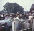
Marple Carnival 1960sA 1960s Carnival Queen passes over Possett Bridge during a Marple Carnival.    
(1 votes)
|
|

Marple Carnival 1960sLittle Bo Peep on Brabyns Brow during a Marple Carnival in the 1960s.    
(1 votes)
|
|

Bottom LockAnother view of Bottom Lock on the Peak Forest Canal.    
(1 votes)
|
|

Marple AqueductA fine view of Marple Aqueduct, unfortunately no longer possible due to the growth of trees.    
(1 votes)
|
|

Mineral MillThe Mineral Mill was part of the Lime Kilns complex, next to Bleak House.    
(1 votes)
|
|
| 2775 files on 232 page(s) |
 |
 |
231 |
|


