| Most viewed - Mellor |

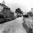
Brook Bottom1226 viewsAnother view of Brook Bottom, Mellor (the bottom of Church Road).
|
|

Brook Bottom1212 viewsBrook Bottom, Mellor (the bottom of Church Road).
|
|

Apple Tree Farm1199 viewsApple Tree Farm on Longhurst Lane, Mellor, from Marple Local History Society Archives.
|
|

Mellor1181 viewsAnother beautiful Mellor landscape with Mellor Church dominating the horizon.
|
|

Bongs (The Banks) Cobden Edge1162 viewsBongs, now know as The Banks, on Cobden Edge. From Marple Local History Society Archives.
|
|

Moorfield Arms1151 viewsA very early picture of the Moorfield Arms, Mellor.
|
|

Cheetham Hill1148 viewsLads enjoying a break at Cheetham Hill Holiday Home, Mellor.
|
|

Cheetham Hill1121 viewsA view of Cheetham Hill, Mellor.
|
|

Banks Holme Cottage1118 viewsBanks Holme Cottage at Lilly Bank Farm. From Marple Local History Society Archives.
|
|

Slack Wood1117 viewsA rather unusual view of Slack Wood, Mellor.
|
|

Devonshire Arms1116 viewsThe Devonshire Arms Public House - it was 30 minutes walk to Marple Locks in those days!
|
|

Tan Pit1116 viewsTan Pit, off Longhurst Lane, Mellor. From Marple Local History Society Archives.
|
|
| 457 files on 39 page(s) |
2 |  |
 |
|

